You’ve reached your limit!
To continue enjoying Utility Week Innovate, brought to you in association with Utility Week Live or gain unlimited Utility Week site access choose the option that applies to you below:
Register to access Utility Week Innovate
- Get the latest insight on frontline business challenges
- Receive specialist sector newsletters to keep you informed
- Access our Utility Week Innovate content for free
- Join us in bringing collaborative innovation to life at Utility Week Live
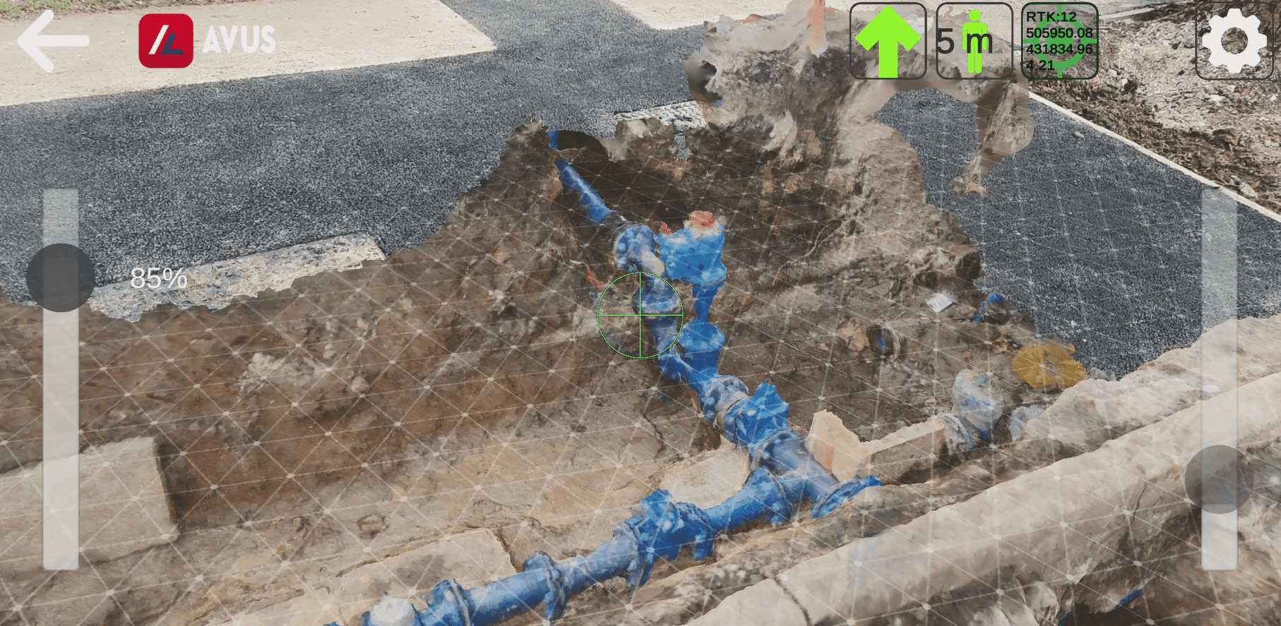
Excavation trials between Morrison Utility Services with Thames and Yorkshire Water have explored the use of augmented reality (AR) to plan and manage underground works before digging begins.
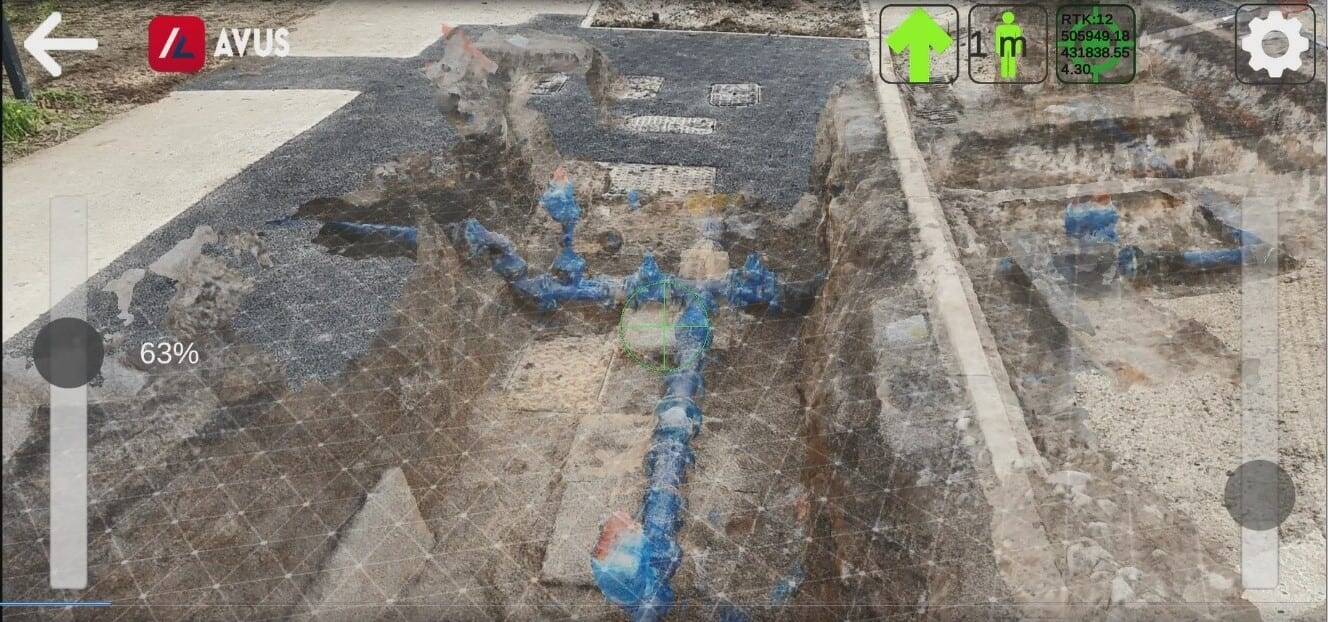
The mapping and viewing ahead of excavation is designed to minimise the risk of underground strikes or third-party asset damage, which pose a health and safety risk as well as reducing productivity.
The trial of augmented visualisation (AVUS) is in partnership with Eurovia to boost operational efficiency, remove the need for specialist surveys and improve the accuracy of underground data over time.
The tool offers pipe location identification to within 5cm and gives users the chance to capture video of as-built geospatial information prior to reinstatement of an excavation. The resulting footage is used to create detailed 3D point cloud models ensuring accurate visual records and X-ray vision of the work completed, utility layout and geology for future works.
The first trial by Morrison Utility Services was on a bypass and pressure relief valve in south London in October 2020.
Andy Carter, director of IT, innovation and improvement at Morrison, said innovation was inspired by real-life business challenges: “AR is paving the way for many operational processes in our sector to become safer and simpler and the benefits presented by AVUS mean that this technology is a real industry game changer.
Carter said the technology minimises the risk of service strikes by giving engineers and operators a view of buried networks via their smartphones or tablets.
“The geo-positioning precision offered by the technology means that the essential infrastructure works that we undertake can be delivered more quickly and more efficiently to keep disruption to the public to a minimum.”
Advances in underground asset management mapping technology led to the UK Geospatial Commissions developing its National Underground Asset Register (NUAR) after trials with Northumbrian Water.


Please login or Register to leave a comment.