The team of river hunters from Thames Water’s innovation team have been collating information from historical maps and records and combining it with data from modern satellite images to track down former rivers – in the hope that many of them can be restored to their former glory.
It comes as the company sponsors London Rivers Week, which is a celebration and recognition of the capital’s vital rivers and canals.
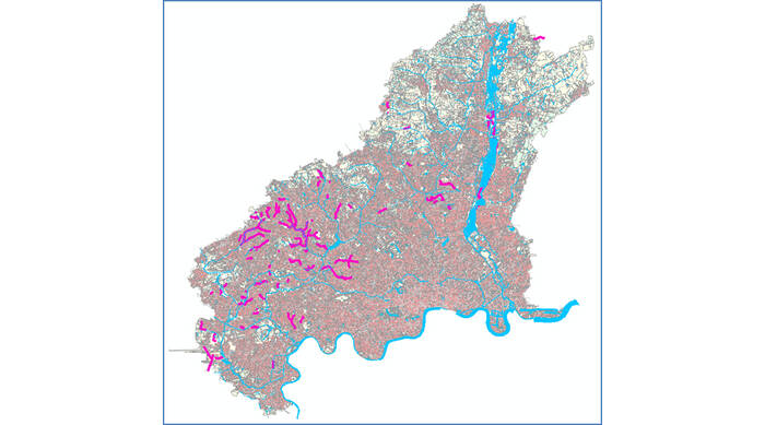
So far, the innovation team has only been able to map North London and predict where these rivers may be, but have already discovered a potential 68km of pipes and tunnels that may once have been natural watercourses but were buried and so became lost from view.
They have been able to do this by creating detailed spatial modelling maps, using all of the combined data plus the known sewer and river network.
David Harding, customer and stakeholder manager, who originally suggested the project, added: “Identification of piped watercourses offers opportunities to restore modified watercourses back to their natural state, known as ‘daylighting’.
“River daylighting is already taking place in towns and cities across the UK, and has many benefits including encouraging more wildlife. I work with many environmental groups and local authorities that are passionate about restoring lost rivers – they just need to know where they are.”
Although the team has only been able to map potential lost rivers in North London, they’re hoping that if they attract the necessary funding, the modelling can be used across the Thames Water region to track down lost rivers.
There are a number of reasons the watercourses were buried, such as to allow for building developments, to help manage flooding risks or to conceal pollution.
Over time their original nature has been lost due to the transfer of records between different organisations. Now they are invisible, both on the ground and on the maps that most people use. Even when pipes are recorded on maps many of them are incorrectly recorded as sewers, which means the ownership of them, and the responsibility for the upkeep of them, is unclear.
These rivers are also often a cause of flooding, when pipes and tunnels become blocked or overloaded. If they’re restored to open river channels that can safely flood, it may help manage flooding in the affected areas.
Rachel Cunningham of Thames’s innovation team said: “Now the potential culverted watercourses have been identified for this trial area, correct ownership can be investigated so there’s a better understanding of the maintenance and cleaning that needs to take place.
“This is a really exciting project and we’re hoping to attract the funding that would allow for this to be carried out across the region.”
A version of this story first appeared on WWTonline.