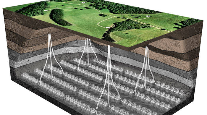
The statement came on the back of a series of maps published by the Environment Agency and the British Geological Society (BGS) showing the distance between the aquifers used for drinking water and shale gas and oil source rocks.
The data revealed that 47 per cent of the area under where principle aquifers are present is underlain by one or more of shales and clays that have the potential for shale gas or oil to be present.
The Bowland shale, in Lancashire, 92 per cent of the shale is at least 800m below principle aquifers that are actively used as a source of drinking water.
The BGS maps also revealed that a chalk aquifer in the South Downs, which is above part of the Weald Basin which could contain shale oil, is at least 650m above the shale rock.
UKOOG stated that the BGS maps will be “immensely helpful” and “help companies minimise the environmental impact of any activity”.
Ken Cronin, chief executive of UKOOG, said: “The mapping of the shale layer and aquifers is an important and useful tool to ensure that the important resources of shale gas in the UK can be accessed for the benefit of the UK with the maximum reassurance for local communities.”
He added that the research has “concluded that any potential risks associated with hydraulic fracturing can be managed in a properly regulated industry.”